Trip Guide for the Burr Trail
We need to begin with the note that there are differing definitions of the Burr trail - we list some of them below the trip guide dialog.
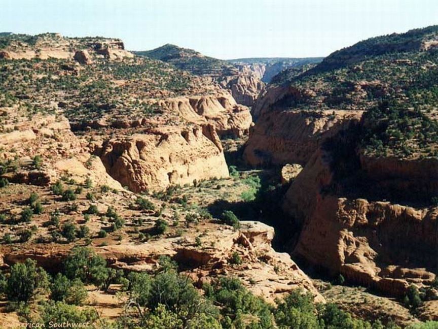
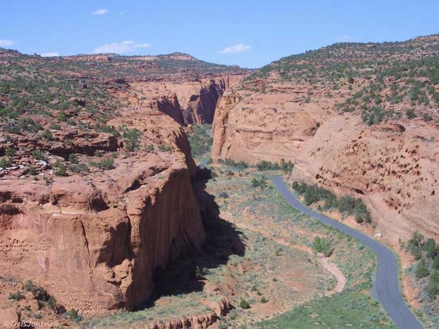
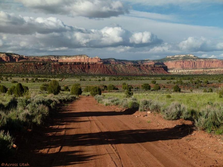
The dialogue that follows is keyed to the Guide Map which follows the Trail from Boulder to Capitol Reef National Park. 6.2 miles east of the junction with Scenic Byway 12 are petrified sane dunes. Deer Creek Campground is at mile 6.7 (map key 9), and at mile 10.6 the Burr Trail loops sharply at the Gulch (photo 1, key 10), and drops into Long Canyon - 7+ miles of oustanding scenery in a narrow canyon with soaring Wingate Cliffs (photo 2, key 10). Check the weather - the canyon is subject to flash floods.
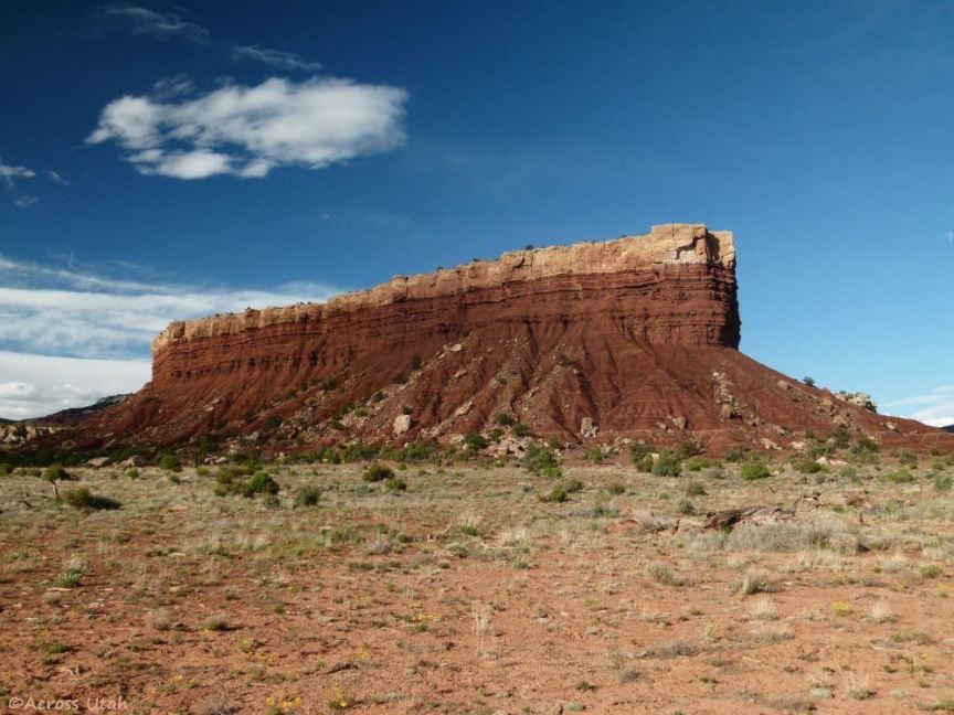
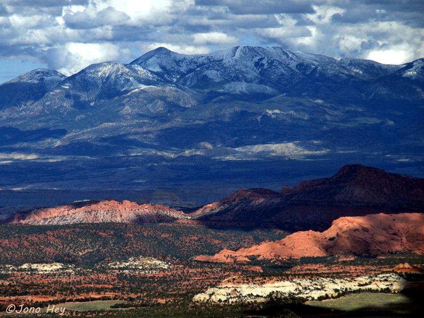
Coming out of Long Canyon at mile 18.5 is the junction with the Wolverine Loop (south), a 28-mile rugged and remote loop with outstanding scenery. Trailheads on Wolverine Loop include Horse Canyon, Wolverine Creek, Little Death Hollow, Silver Falls Creek, and Moody Canyon. The loop rejoins the Burr Trail 11 miles east of mile 18.5 at mile 29.5. And, at mile 18.5 (and at 24.3 - the two roads meet) is a 5-mile road north to an unusual butte, the Lamp Stand (photo 3). The Burr Trail descends from a plateau, nearing the border of Capitol Reef National Park, with an outstanding panorama of the jagged, brilliantly-colored west side of Waterpocket Fold (photo 4, shot from Miners Mountain).
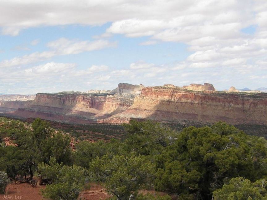
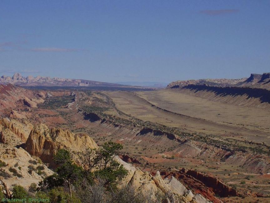
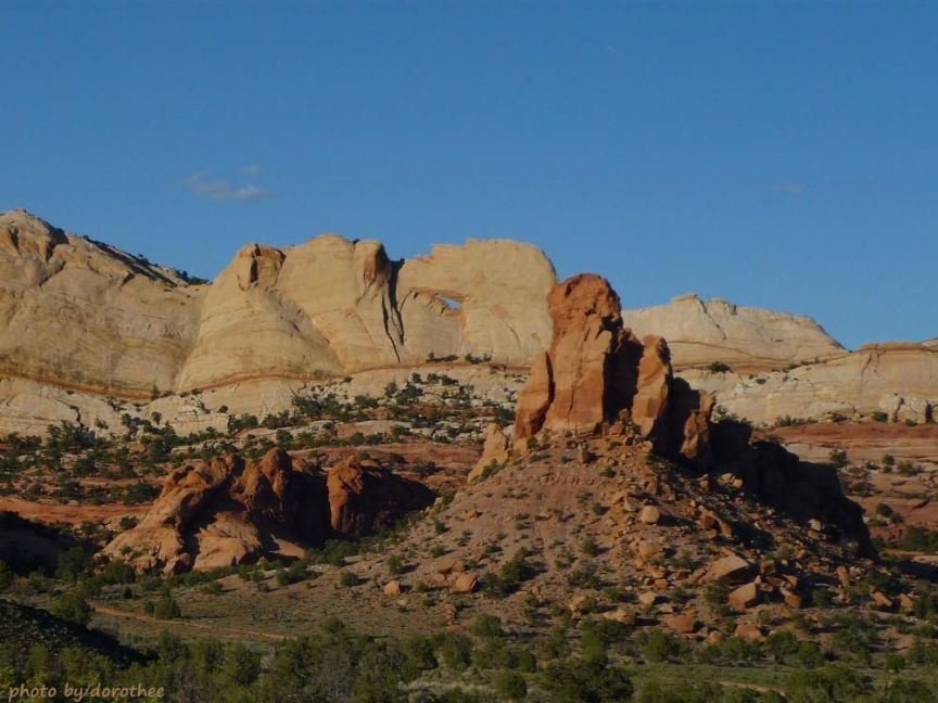
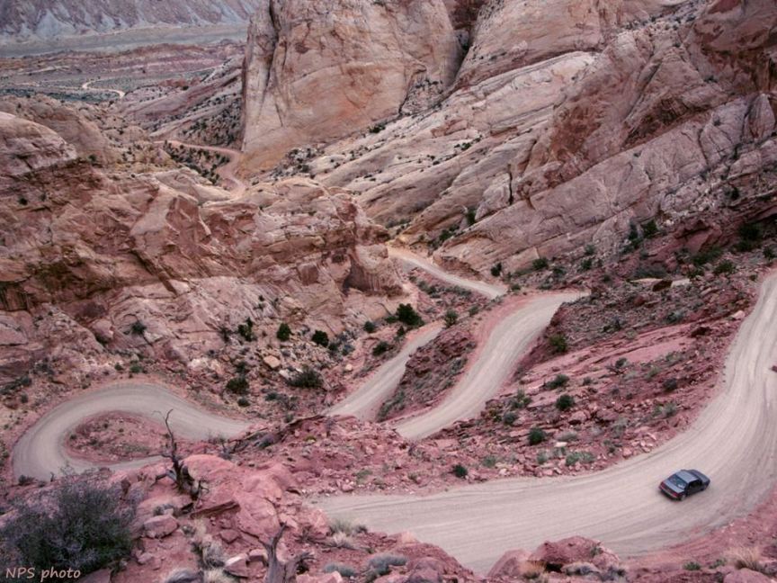
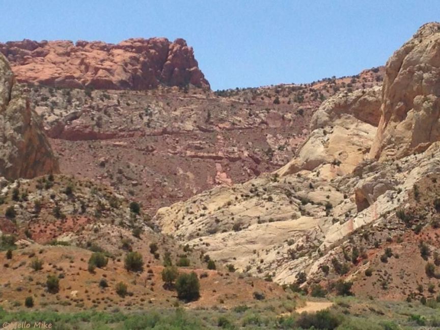
The pavement ends at at mile 31.2, the boundary of Capitol Reef National Park. At this point (mile 31.2), all five peaks of the Henry Mountains are visible (photo 5, viewed here from Boulder Mountain), and the area is surrounded by the Red Circle Cliffs (photo 6). At mile 31.4 is a Pinon/juniper forest (elevation 6,000'). At mile 31.7 is a picnic area. At mile 33.4 is the junction with the road to Upper Muley Twist Canyon, a rough 4WD road and trail to Strike Valley Overlook, a photographer's favorite spot for the Waterpocket Fold S-bend (photo 7), and the west side of Peek-a-Boo Arch (photo 8) is visible at mile 33.4. Mile 34.5 is the top of the switchbacks across Waterpocket Fold (photo 9), through Burr Canyon, to the bottom of the switchbacks at mile 35.8. Peek-a-Boo Arch (photo 8) is visible at mile 36.5. The last photo looks back at the switchbacks across Waterpocket Fold from the Burr Trail near its junction with the Notom-Bullfrog Road at mile 36.6.
The guide map ends at the edge of Capitol Reef (mile 31.2) with a light gray arrow pointing the rest of the way. The Burr Trail meets Notom-Bullfrog Road at mile 36.6,where some consider the Burr Trail ends. The NPS map indicates that the Burr Trail continues along the Notom-Bullfrog Road for 31.8 miles to U276 north of Bullfrog, turning right at mile 47.7 on paved road 531 - the continuation of Notom-Bullfrog Rd.
The Surprise Canyon trailhead is at mile 38.4. The Trail leaves Capitol Reef National Park at mile 39.9. Halls Creek Overlook Road turns to the left at mile 48.6. It is 3 miles on rough road to the overlook which offers an outstanding view of the Waterpocket Fold and Brimhall Natural Bridge, an unusual double arch (photo in the gallery). At mile 55 is another view of the Henry Mountains. At mile 57.8 is an awesome viewpoint: to the southeast is Navajo Mountain; to the west is Waterpocket Fold; and to the south is a view of Upper Bullfrog Bay and Upper Halls Creek Bay. At mile 59.5 is the boundary of Glen Canyon National Recreation Area, featuring Lake Powell, which includes Upper Bullfrog Bay and Upper Halls Creek Bay. The NPS version of the Burr Trail ends south of the junction of U276 at mile 67.4, just north of Bullfrog.
Another version of the Burr Trail does not turn south at mile 47.7 but continues on the Starr Springs road through the southern end of the Henry Mountains, past Starr Springs campground, for 26 miles to U276 north of Bullfrog, for a total length of 74 miles.
The original Burr Trail was just Burr Canyon - the switchbacks across Waterpocket Fold - 3 miles long.
Back at the Burr Trail - Notom-Bullfrog Road junction, for a scenic loop, turn north on the Notom-Bullfrog Road to U24, west through Capitol Reef National Park to U12 at Torrey, then back to Boulder for a scenic loop (obviously, this can start from any point - Boulder, Torrey, Capitol Reef, etc.). It should be noted that any of the dirt roads may be impassable during/after rain.
Select a tile above to view its photo. The Photo Gallery has scenic views along the Burr Trail; View Photos is an auto-show of the photos.