Canyonlands National Park
Canyonlands National Park (Canyonlands) and Glen Canyon National Recreation Area (GCNRA) are two huge NPS protected areas in southeastern Utah - side-by-side with a common east/west boundary for the length of Canyonlands. GCNRA on the west is long and narrow, continuing south for perhaps 225 miles (362 km) beyond Canyonlands to the historic Navajo Bridge (overlapping the Grand Canyon park boundary). This article features Canyonlands - GCNRA, essentially Lake Powell, is featured in a separate article.
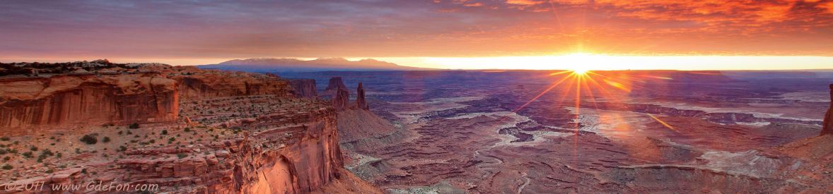
Canyonlands is isolated, desolute, rugged bear country with no potable water, no services, but with awesome vistas, outstanding geology, challenging trails, and interesting canyons that draw nearly half a million visitors every year. The 100-mile White Rim Trail around the Island in the Sky mesa can take two days to tour (some say 12 hours), longer if taking side trails for awesome vistas and pre-historic ruins.
Canyonlands, 527.5 mi² (1,366.2 km²), is divided by Green and Colorado Rivers into four isolated districts: Island in the Sky District, where the main attractions are overlooks, trails, and roads (White Rim and Shafer Trails), the Needles District, which has awesome geology, the isolated backcountry Maze District, and the Horseshoe Canyon Unit with rock art, detached to the west beyond GCNRA. Barrier Canyon with rock art panels, mostly pictographs with several petroglyphs, was renamed Horseshoe Canyon when it was added to Canyonlands in 1971 to protect the rock art.
Outside the park, the Needles and Anticline overlooks offer outstanding views across the Needles district and Shafer Basin into Canyonlands. The Needles Overlook Road turns west off US191 approximately 45 miles north of Monticello. The overlook is 22 miles from US191; the road to Anticline Overlook turns off the road (see the map) 14.5 miles from US191, then 17 miles down the sometimes-washboard graded road to the overlook.
The Island in the Sky district can be reached via U313 from US191, 40 miles north of Moab, Utah; the Needles district via U211 off US191 34 miles north of Monticello, Utah; the Maze district is really difficult - 20 miles from U24 on a 2-wheel-drive dirt road to Hans Flat at the edge of GCNRA, then 25 miles of 4-wheel-drive trails that require a backcountry permit across GCNRA to the Maze, an alternate 58 mile 4-wheel-drive trail (NPS 633) from U95 near Hite, Utah, is sometimes open; the Horseshoe Canyon district via dirt roads - 49 miles on Lower San Rafael Road fron Green River, Utah, or 32 miles from U24 near the Goblin Valley turnoff on Hans Flat and Lower San Rafael Roads. There are no roads connecting the districts.
The Photo Gallery contains photos of Canyonlands National Park including photos from Needles and Anticline Overlooks that are outside the park.
View Photos is an auto-show of the photos.
Geology is an NPS pdf article explaining the weathering of the rock in the park that created the outstanding geology.
Maps includes a map of Canyonlands, and maps of each of the districts, some include the GCNRA, Overlooks roads includes U211 into Needles.
Complementary photos and information are in the Green River and its Canyons and Canyons of the Colorado River articles.