Cedar Mesa
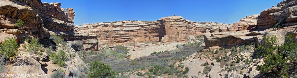
Cedar Mesa is a plateau in southeastern Utah. The Mesa extends from Elk Ridge (Abajo Mountains) in the north, to Comb Wash on the east, to the gorge of the San Juan River on the south, and to Utah 276/Red House Cliffs on the west, an area of over 400 square miles (1,000 sq km). Utah 261 crosses the center of the plateau, which reaches an elevation of 6,500 feet (2,000 m). The surrounding area has a typical elevation of 4,200 feet (1,300 m), from 6,425 (1,958 m) at Moki Dugway, to 3,890 feet (1,186 m) in the San Juan gorge. This large difference in elevations led to the formation of numerous canyons, cliffs, and other erosional features that drain from the center of the Mesa into Comb Wash, Grand Gulch, and the San Juan. Scattered throughout these canyons are innumerable archaeologic sites, as may be seen on the Mesa map, and a plethora of scenic views. The banner image is a wide-angle view into Grand Gulch.
The earliest known documented inhabitants of the Cedar Mesa area were the "Archaic," a highly mobile, low-density hunting and gathering culture which depended on wild animals and plants, probably exploiting resources through seasonal movement using open campsites and natural shelters. Recent research indicates that they were moving through the area from B.C. 6500 to B.C. 1500. Following the Archaic Period, there was a substantial increase in population during the Basketmaker II Period (B.C.1500-A.D. 400). Cedar Mesa appears to have been abandoned from approximately A.D. 400 to 650, and was again reoccupied during the late Basketmaker III phase; A.D. 650-725.
Cedar Mesa is a popular area for hiking and backpacking to see Ancestral Puebloan cliff ruins and rock art in a natural setting, with many miles of spectacular canyons lined with cliffs cut across the mesa. Some ruins are amazingly inaccessible, perched high on ledges and under overhangs. On its eastern edge the mesa’s caprock dips sharply downward along Comb Ridge to Comb Wash. It is quite likely there are many yet-to-be-discovered sites. Many canyons cut through this area. Other attractions include the scenery and wildlife, as well as the solitude of desert canyons.
The Photo Gallery includes photos of canyons, ruins, and a wide-angle view inside Cedar Mesa.
View Photos is an auto-show of the Cedar Mesa photos in the photo gallery.
Cedar Mesa Map shows roads, canyons, and ruin sites inside the Cedar Mesa plateau. It may be difficult to read on low resolution monitors.
Road Map of the Cedar Mesa area is a BLM map that includes San Juan County dirt roads and Wilderness Study Areas. The unidentified road through the center is Utah 261. Near the bottom are the Moki Dugway switchbacks, with the Muley Point overlook road just before Moki Dugway and county road 242 - the Valley of the Gods Road - below the switchbacks. US163 on the bottom right of the map is incorrectly identified as Utah 163.