Drought in the Colorado River Basin
The Colorado River Basin provides life-preserving water for 40 million residents in seven southwestern US States and two Mexican States in this arid desert region, and electricity to surrounding areas.
Lake Powell in the Glen Canyon National Recreation Area (GCNRA), created by the Glen Canyon Dam, and Lake Mead in the Lake Mead National Recreation Area (LMNRA), created by Hoover Dam, the two largest reservoirs in the US, provide flood control and a steady water supply throughout the Basin.
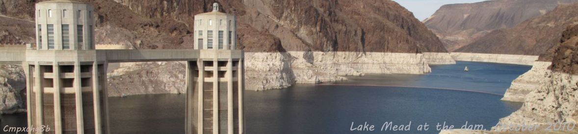
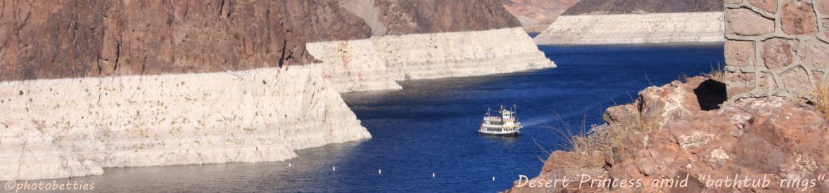
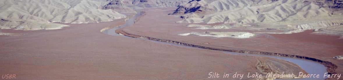
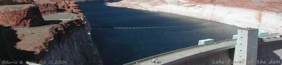
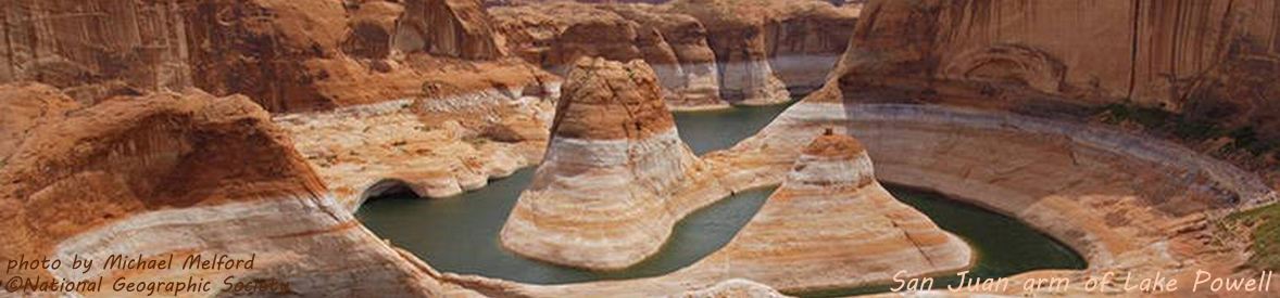
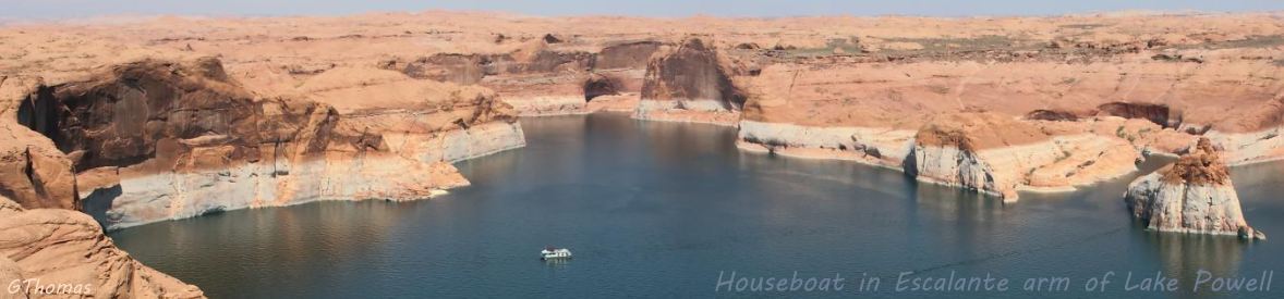
Cycling banner photos include Lake Powell at the dam, the San Juan Canyon arm of Lake Powell, a large houseboat in the Escalante Canyon Arm of Lake Powell, Lake Mead at the dam, the Desert Princess paddlewheeler amid huge bathtub rings
near Hoover Dam, and silt in the dried-up eastern end of Lake Mead where the Colorado enters LMNRA as it exits the Grand Canyon.
Since 1999 the US southwest has been in a severe drought. Between 1999 and 2005, Lake Powell dropped 145 feet (44+ m) to 33% of capacity. July 1, 2016, Lake Mead set an all-time low, down 148 feet (45 m). This is a combined loss of nearly 11 trillion gallons of water from both lakes. With the extremely low snowmelt runoff this year the current outlook is not good.
Rivers feeding Lake Powell are at 57.7% (31 August 2020).
This graph for the year ended 31 August, 2020, shows the Lake Powell elevation down 1.7 feet (0.4 m) from last year.
An  NPR article (KRCC, March 15, 2018) tells the continuing story of the drought.
July 18 elevations: Lake Powell is down 91.3 ft (27.8 m) and Lake Mead is 134 ft (41 m) below full pool, 39.3 feet (12 m) below drought elevation.
NPR article (KRCC, March 15, 2018) tells the continuing story of the drought.
July 18 elevations: Lake Powell is down 91.3 ft (27.8 m) and Lake Mead is 134 ft (41 m) below full pool, 39.3 feet (12 m) below drought elevation.
The Photo Gallery provides beautiful scenery of Lake Powell and Lake Mead in drought with bathtub rings.
Deposits of calcium carbonate and other hard minerals on the darker-colored surface of the sandstone is what causes this water-bleached effect which is observable when the water levels are down - dramatically during drought.
Some of the photos in the gallery come from the Glen Canyon NRA (Lake Powell) and Lake Mead NRA articles, which have additional information and photos that pertain to their recreation areas.
View photos is an auto-show of the gallery photos.
Satellite images are Lake Powell and Lake Mead NASA satellite image overlays in an auto-show that illustrate the progression of the drought.
Drought updates presents periodic updates with data and graphs of the lakes' elevations and basin snowpack. Drought defined discusses the probem of defining a drought, ultimately deferring to the National Drought Mitigation Center at the Unversity of Nebraska/Lincoln for our definition.
Basin drainage has a map of the drainage of the Colorado River Basin, with maps of the drainage basins of the three largest tributaries of the Colorado: Green River, San Juan River, and Gila River. Basin graphic is a graphical view of the Colorado River Basin.
Select Minute 319 from the menu for information on the historic agreement between the US and Mexico on the storage-and-release of Mexico's water allotment that allowed the Colorado River to reach the ocean (Gulf of California to the Pacific Ocean) in 2014 for the first time in 16 years.