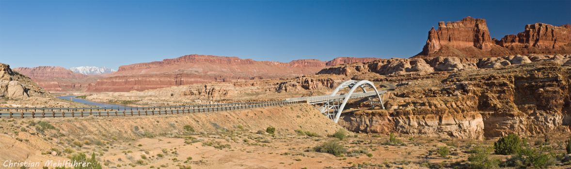
The Bridge at Hite Crossing
The Bridge at Hite Crossing carries Scenic Byway U95 over the Colorado River and the northeastern end of Lake Powell near Hite, Utah, at the confluence of three canyons: Cataract Canyon, Glen Canyon, and the Dirty Devil River, inside the huge Glen Canyon National Recreation Area. The Bridge at Hite Crossing is the only bridge crossing the Colorado River for the 295 river miles (474.76 km) between the US191 bridge at Moab and the Glen Canyon Dam Bridge at the southwestern end of Lake Powell near Page, Arizona. Scenic Byway U95 is on the Trail of the Ancients, the only National Scenic Byway totally dedicated to archaeology.
Hite, Utah, the original site of Hite Crossing, and currently the site of Hite Marina on Lake Powell, is tiny - population 117 in 2011, cost of living index 78.6, sits on the bank of Lake Powell at normal lake levels but not in today's drought - Hite Marina has been open only once in the last decade. Hite is surrounded by awesome scenery and geology in Glen Canyon NRA, nearby state and national parks and monuments, scenic byways, and wilderness and primitive areas. Natural Bridges Natioanl Monument is a few miles southeast on U95, Canyonlands National Park and Dead Horse Point State Park are a few miles upstream.
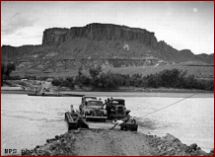
Chaffin (Hite) Ferry, 1946, ilovehistory.utah.gov, Road from Hanksville to Hite, 1946, NPS photo; select a tile for a larger view
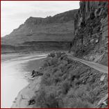
Historical Hite Crossing, now under water, is 2 miles south of the bridge. Cass Hite came to Glen Canyon in September, 1883. He built the first structure in the town that bears his name, a cabin of notched logs salvaged from the river. A post office was established in 1889. A dirt road between Blanding and Hanksville was built in 1946 and a ferry at Hite Crossing started on September 17, 1946 (photos on the right). Before the ferry, one had to cross the river the best way one can - swimming the horses and mules or trying to find a boat. The ferry continued to operate until June 5, 1966, when the Bridge at Hite Crossing was completed, and Lake Powell began to fill in Glen Canyon after the dam was built.
View Photos is an auto-show of the bridge photos with the Bridge at Hite Crossing panorama as the last photo.
Hite Area Map is a segment of the NPS Glen Canyon National Recreation Area map.