Comb Ridge
The Comb Ridge monocline (Navajo: Tséyík'áán, Rock Extends in the Form of a Narrow Edge
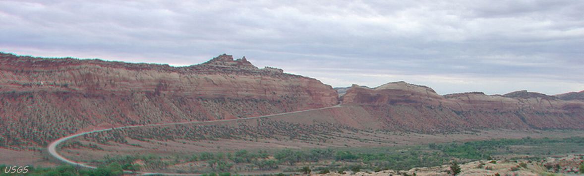
) runs 120 miles from an Ute Indian Village in southeastern Utah to Kayenta, Arizona; in Utah to the San Juan River, where it crosses into Navajo Nation; between San Juan River and Kayenta, Comb Ridge is inside Navajo Nation, roughly parallel to US163.
It is visible along US163 and from US160 near Kayenta.
Our photos are from U95 and US163 in Utah.
Comb Ridge was designated a National Natural Landmark in 1976 as the only North American location of tritylodont fossils (image on the right).
Tritylodonts ("three knob teeth", named after the shape of the animal's teeth) are interesting little creatures that varied in size from a rabbit to a beaver.
They were the longest surviving of all the non-mammalian therapsids, descended from a Cynognathus-like cynodont.
They appeared in the latest Triassic period, and persisted through the Jurassic period until the middle of the Cretaceous period, coexisting with and surviving under foot of the dinosaurs.
[source:  Wikipedia]
Colorado Plateau monoclines (including the four we cover: Comb Ridge, Waterpocket Fold, Raplee Ridge, and the Cockscomb (select the Four Monoclines button for a satellite image) are thought to have formed millenia ago during the Laramide orogeny when the Rocky Mountains were formed - how so is uncertain, but generally believed to be from tectonic plate subduction as indicated in the Wikipedia Laramide orogeny article.
Many Ancestral Puebloan sites may be found inside the eastern edge of Comb Ridge from Butler Wash, in the canyons off Comb Wash on the west side like Mule Canyon, and many other sites just west of Comb Ridge in the canyons in Cedar Mesa. This and a host of other sites in our Archaeology menu are in the Four Corners area - the greatest concentration of Ancestral Puebloan cultural sites north of Mexico.
View Photos is an auto-show of the photos in the Photo Gallery of Comb Ridge, ancestral Puebloan ruins and art, an aerial view of the teeth
of Comb Ridge including San Juan River and Bluff, Utah, and terminates with a panoramic view of the U95 cut through the Ridge.
The Butler wash map identifies ruins for 13 miles along the trail north of the trailhead at the south end of the wash near US163.
Four Monoclines is a Google Earth satellite view of Comb Ridge and three other area monoclines.
Laramide orogeny discusses mountain-building in western North America.