Glen Canyon National Recreation Area
The Glen Canyon National Recreation Area (Glen Canyon NRA,GCNRA) was established in 1972 to provide for public use and enjoyment and to preserve the area's scientific, historic, and scenic features.
Glen Canyon NRA occupies 1,959.6 mi² (5,075.3 km²) with the major attractions of Lake Powell and Rainbow Bridge (2.3 million and 100,000 visitors annually).
Lake Powell is a reservoir on the Colorado River, created by the flooding of Glen Canyon by the Glen Canyon Dam (which led to the creation of Glen Canyon NRA).
It is the second largest man-made reservoir by capacity in the United States behind Lake Mead.
The reservoir is named for explorer John Wesley Powell, a one-armed American Civil War veteran who explored the river via three wooden boats in 1869.
The southwest boundary of GCNRA is Navajo Bridge over the Colorado in Marble Canyon, the northeast boundary of Grand Canyon National Park. GCNRA extends up many canyons, extensively up the San Juan to near Goosenecks State Park. It follows the Colorado from Glen Canyon into Cataract Canyon to the boundary of Canyonlands NP, where it continues north alongside Canyonlands with the Orange Cliffs until its northern boundary at Canyonlands northern boundary. Rainbow Bridge National Monument, a separate unit inside of and managed by Glen Canyon NRA, and the Horseshoe Bend viewpoint inside Glen Canyon NRA 5 miles (8 km) south of the dam, have separate articles with their stories and photos.
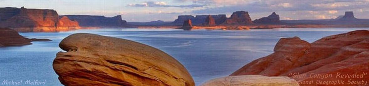
Lake Powell is a gangling lake with long arms extending up canyons and tributaries on both sides along the 186-mile channel of the Colorado River in majestic Glen Canyon, with a shoreline exceeding 2,000 miles - longer than the entire west coast of the US.
The lake twists and turns, with river arms and canyons 15 to 20 miles in length - there are 96 major canyons off Lake Powell.
Five marinas and a number of primitive launch points provide boating access to Lake Powell.
Hite Marina and most primitive ramps are currently closed by an extended drought (see Colorado Basin Drought).
Many of the photos show the depth of the drought with bathtub rings
from calcium carbonate and other hard minerals in the water that were attached to the darker-colored sandstone during the lake's higher elevations.
There was some relief in water year 2016-2017 when the lake raised 41' (12.5m) during spring runoff, but the lake was still 71 feet (21.8 meters) below full pool.
Not so in the 2017-2018 water year when the lake raised less than 4 feet (1m) during runoff.
This image from the Colorado Basin Drought Update article shows the lake's level for the last five years.
The photo Gallery includes scenic photos inside Glen Canyon NRA including photos from contests, Rainbow Bridge, and Horseshoe Bend. View Photos is an auto-show of the photos in the Photo Gallery. GCNRA Map is a huge NPS pdf map, showing the expanse of Lake Powell and its arms of canyons and rivers, highways, and the surrounding area. Powell Map is a small map of just the lake and its attractions.
Glen Canyon National Recreation AreaNational Aeronautics and Space AdministrationNASA Sat Images is a continuous auto-show of annual NASA Earth Observatory satellite images of upper Lake Powell to visually show the yearly changes of the lake's surface area, with pause/play, stop (exit), and annual control buttons, that dramatically show the effect of the drought.